
digin.ridesmmb.org
SMMB has been selected as one of 9 organizations across the country to receive a matching grant from IMBA/Shimano. The Dig In grant is a $5,000 award, but here’s the catch. We must raise $5,000 to receive the grant.
Please consider donating to SMMB through Dig In grant. Together we can get more trails in Southern Maryland.
This fundraising effort is just one part of goal to reach $50,000 by the end of 2024. Our hope is to have new at least 1.3 miles of new trail by the end of 2025.
State Forest – Walton Track Trail Expansion
Follow the link above and click donate to support the effort!
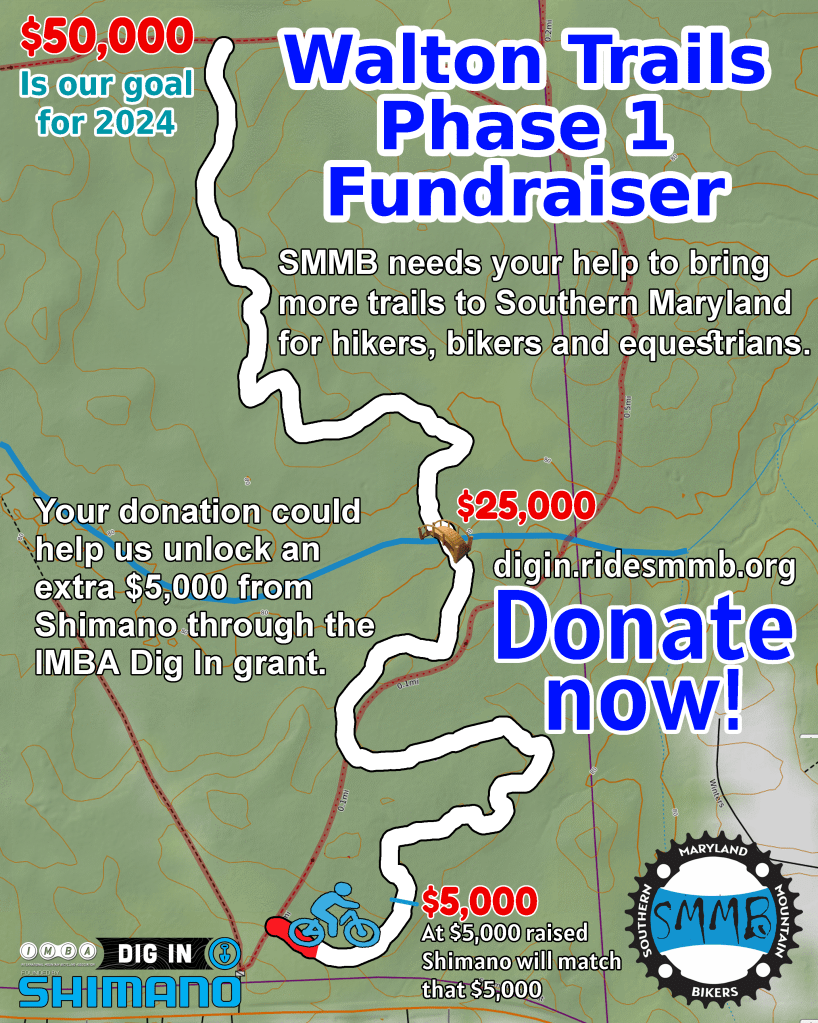
As of 9 April we are at $1,500 collected
Starting in March of 2023 we began talks with the MD State Forest Southern Regional Forester to improve the access to the lake from the MD Route 5 State Forest parking lot. From these talks we began plans for a 3 phase approach to first move trails away from privately owned property adjacent to the State lands, and to build a new bridge that would be safer than the one that is in place currently. This first phase would utilize contour trails to improve user experience as well as improving the life and maintenance of the trail itself. This first phase will create approximately 1.6 miles of new trail.
We are applying for state grants in 2023 with the hopes to build the trail in 2024.
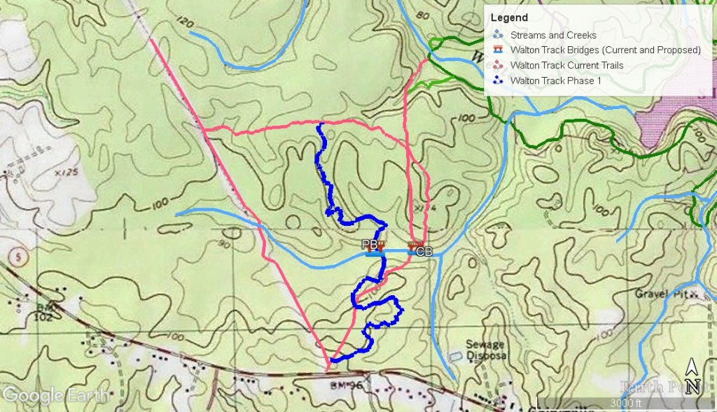
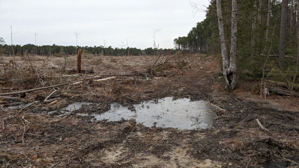
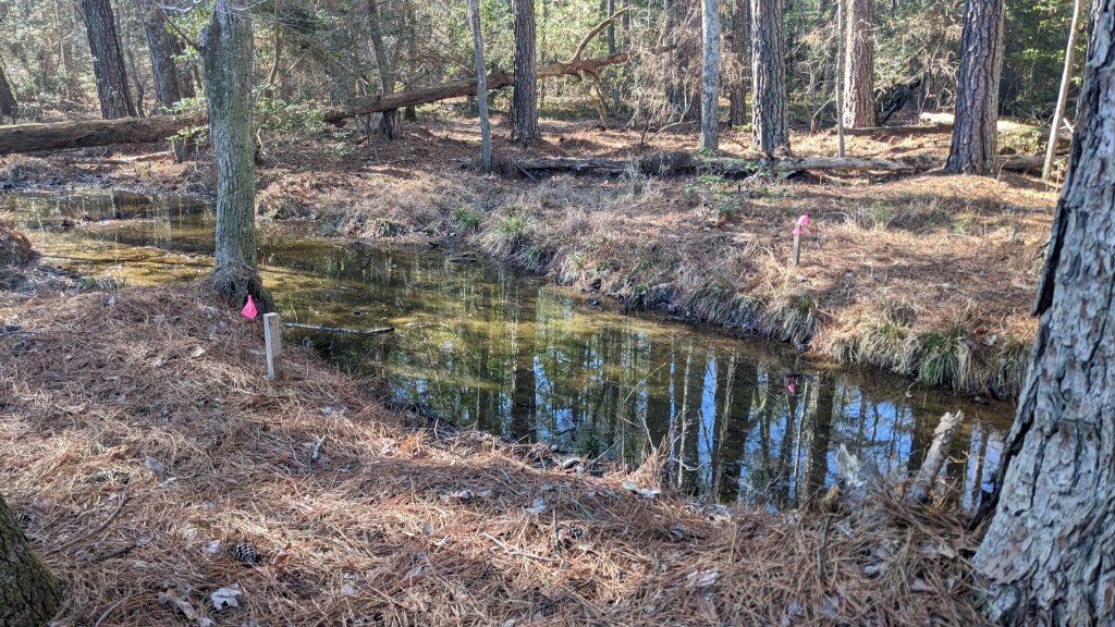
To facilitate the new trail we are planning to build a 16 foot long puncheon to cross a small wet area toward the beginning of the trail. This is to avoid the one area of the current trail that is flooded out 95%, or more, of the year (pictured below).
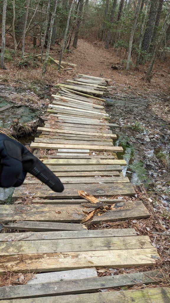
Additionally the new trail would relocate the bridge that is needed to cross a creek from the border of the State owned property to well inside the State Property. Additionally the current bridge that is installed is not very safe and the location of that bridge is surrounded by low lands that are consistently wet. The picture below shows the current bridge in March of 2023.
The new bridge site is at a narrower section of the creek with defined creek banks and is less likely to be wet. The run up to the bridge and exit from the bridge will need some puncheon to ensure the lower laying land in that section of the forest is not damaged by the trail traffic. The proposed bridge site is pictured below.
Beyond Phase 1
Phase 2 would create around 3.2 miles of new trails that could be connected to the Phase 1 trail to make a large loop on the Walton Track property. Additionally a smaller “beginner loop” could be created with a portion of of the Phase 1 trail to make a loop that would be around 1 mile for newer or younger riders.
And Phase 3 would add a final stretch of 2.2 miles of new trails that would link Phase 1 to Phase 2 to allow the closure of the old logging trails from recreation and create a loop of about 7 miles of new trails on the western end of the lake. This loop would still be connected to existing St Mary’s River State Park trails.

Other plans in
St Mary’s County
We have plans for improving the trails on the Salem Lot on the North side of the lake to utilize the terrain rather than the using the logging roads to access the lake trails.
